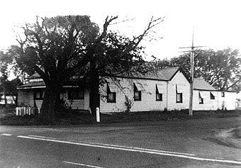
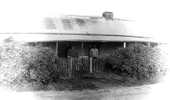
In the 1900 Victorian Municipal Directory, Shire of Bellarine, Moolap is described as :-.
Small postal village 50 miles S.W. of Melbourne and a station on Queenscliff line; fares, 8s. 11d. and 5s. 11d. Coach from Geelong daily at 9 a.m. arriving at 9.30 a.m.; fare 6d. Eliza Yeoman, postmistress. (1)
Over the years, Moolap has been described as having "elastic Boundaries". A 1865 description included a steam flour mill and a tannery in an agricultural district. It's hotels were the Plough, Moolap and White Horse and the scattered population at the time was about 800. This description seems to cover the area also referred to as East Geelong.
The White Horse Inn was on the corner of White Horse Road and the Queenscliff Road; the Moolap Inn still stands on the corner of Moolap Station Road and the Bellarine Highway; and the Moolap Hotel was on the corner of Clifton Lanes and the Portarlington Road.
|
Moolap was situated between Point Henry and Kensington, and initially had no church or school - the children either didn't attend school or travelled a couple of miles to the Point Henry School. It was not until 1871 that Moolap obtained its own school (Moolap South No. 1143), using the Moolap Hotel building which was offered by it's recent owner, Thomas Sutterby. A new school was built in 1877 taking pupils from the Point Henry and Moolap South schools. The school's name was later changed to Point Henry.
|
In 1888, Richard Cheetham established his saltworks at Moolap - an industry which survived more than 100 years.
The first subdivisions were in 1852-53. The Moolap Estate contained 194 half acre lots from the north-west corner of Coppards and Woods Roads. (2)
A site of architectural significance has been identified at Moolap - "Crescent" in Earles Road. In the recent Bellarine Heritage Study it has been given an "A" classification. At one time it was thought to have been a nursing home. It was one of the few buildings recorded as part of the Study "as an Historical archaeological site on the Bellarine Peninsula, that appears to have been constructed of hand-made or wire-cut bricks." (3)
References :
- Victorian Municipal Directory, 1900
- Ian Wynd, Balla-wein : A history of the Shire of Bellarine, Shire of Bellarine, Drysdale, 1988, pp. 24, 96-98.
- Huddle, Howe, Lewis, Francis, Bellarine Heritage Study : Volume Three - Culturally Significant Places, City of Greater Geelong, 1996, Record No. 149.
Record Sources for Moolap
- Photographs : Bellarine Historical Society; Geelong Historical Records Centre; various private collections.
- Maps & Plans : Bellarine Historical Society; Geelong Historical Records Centre.
- Newspapers : Geelong Advertiser Indexes - Bellarine Historical Society & Geelong Historical Records Centre; Geelong Advertiser on microfilm - Geelong Historical Records Centre; various local newspapers - Bellarine Historical Society.
- Miscellaneous Documents & Advertisements : Bellarine Historical Society; Geelong Historical Records Centre; various private collections.
- Bellarine Shire Council Records : Geelong Historical Records Centre.
- More recent Council Records : City of Greater Geelong.
- Cemetery Records : (Geelong & Leopold Cemeteries) Bellarine Historical Society; Geelong Historical Records Centre.
- Land Records : Registrar of Titles, Melbourne; Bellarine Historical Society; Geelong Historical Records Centre.
Bibliography
Brownhill, Geo. H. Illustrated Guide to Geelong And District, Facsimile edn., Deakin University Press, Geelong, 1990.
Campbell, A. J. Tourist Guide to Geelong and Southern Watering Places, Henry Thacker, Geelong, 1893.
Richardson, John. The Lady Squatters : Miss Anne Drysdale and Miss Caroline Elizabeth Newcomb : 'Boronggoop' and 'Coriyule', Bellarine Rural City Council, Drysdale, 1986.
Wynd, Ian. Balla-wein : A history of the Shire of Bellarine, Shire of Bellarine, Drysdale, 1988.
Wynd, Ian. Geelong The Pivot : A Short History of Geelong and District, Cypress Books, Mont Albert North, 1971.


